Agricultural sediments transported by rivers
The QuASPEr project studied the Canche river basin in northern France to better understand the phenomenon of soil erosion and its related consequences. This knowledge aims to develop effective land management methods for municipalities without negatively affecting farmers’ work.
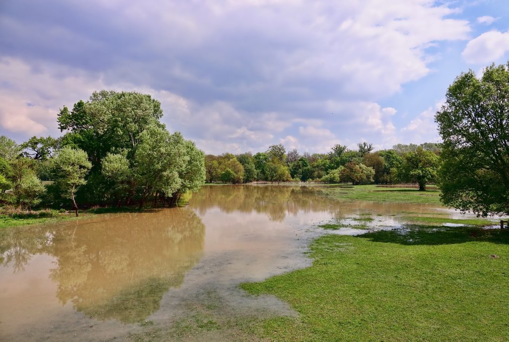
Heavy rain, dry land, sloping ground that has been tilled… and the soil erodes. This phenomenon of abrasion, in particular of agricultural soils, leads to a loss of fertile soils but also lowers water quality in rivers. For local stakeholders, this can be seen in the form of mud flows with silting of waterways and damage to infrastructures. Northern France, which is particularly affected by this phenomenon, was the subject of the QuASPEr project (French acronym for Quantification, Analysis and Monitoring of Erosive Processes), in partnership with the joint association Symcea, the Artois-Picardie Water Agency and two IMT schools. Claire Alary and Christine Franke, researchers at IMT Lille Douai and Mines ParisTech respectively, have studied the Canche river watershed to better understand this erosion and develop effective soil retention strategies. The team also includes Edouard Patault, a PhD student who studied the Canche river watershed for his thesis research.
“The aim of this project is to characterize, model and predict this phenomenon of erosion,” says Christine Franke. “And due to climate change, these phenomena will evolve – and not necessarily for the better. It’s important to have a clear understanding of these mechanisms to propose management plans,” adds Claire Alary. The two researchers have been working on the topic for several years in an effort to gain a better understanding of the highest-risk areas in the region.
Soil erosion
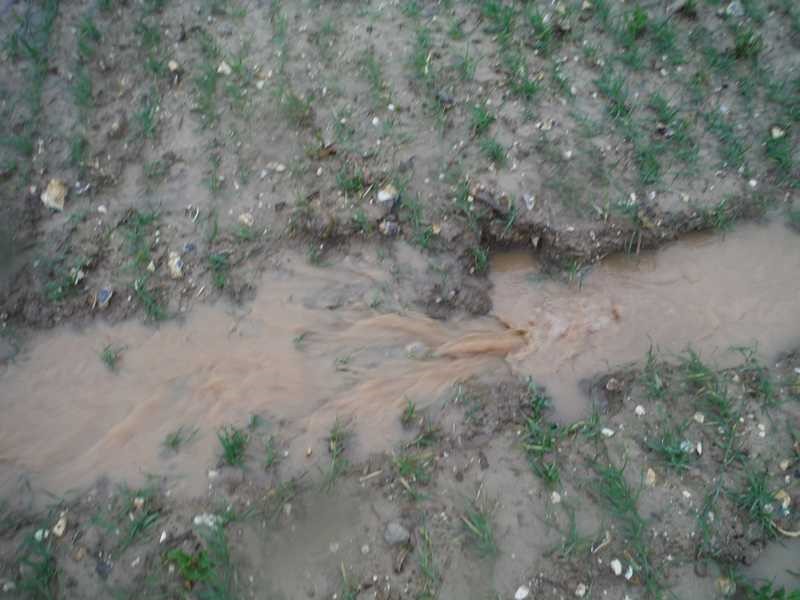
To study the phenomenon of erosion, the first thing that is necessary is a good understanding of the area. “It’s not necessarily a phenomenon of heavy rain that causes this erosion,” says Christine Franke. A number of parameters must be taken into account and this phenomenon is highly variable. The first rains of the season can often trigger erosion since the soil is dry and erodes more easily. The duration and intensity of the rain are significant factors but the type of soil is also very important: soil composition, vegetation cover, the degree of slope of the land etc.
This soil erosion is a recurring problem and it is difficult to identify the causes. A watershed like that of the Canache river is divided into a number of small basins, and the researchers’ goal is to find out the precise area from which the eroded particles come. To do so, it is critical to have a precise understanding of the system at each instant. Installing a monitoring station allows for such an understanding, but very locally, and stations are too expensive to be placed throughout the watershed. They must therefore be combined with other techniques to get a clear view of the system and its variability over time. The researchers studied this through the magnetic fingerprint of the sediments, a technique they adapted to this erosion phenomenon.
“We installed a trap in the river to collect these sediments suspended in the water and then sent them to the laboratory to be studied,” explains Christine Franke. The method is relatively easy to implement and accessible for the municipalities. Moreover, it is a non-destructive method, meaning that researchers can carry out several analyses on a single sample. In practice, what they study is the mineralogy of iron in the samples. “The iron particles present in agricultural soils are not the same as those found naturally in the river,” she adds.
They have a distinctive signature that allows researchers to differentiate between particles from rivers and from fields. “The eroded particles from the field will keep this signature for a fairly long time once they’re in the river,” explains the researcher. This erosion phenomenon is also characterized by a procession of geochemical elements for each material arriving in the river. “We know the chemical characteristics of the sources of the material, so we’re able to trace this signal back to determine the contributions of the sources from which the sediments originate,” says Claire Alary.
Photograph of a gully in the Canche river watershed
Land management
This project seeks to better understand how the system functions overall in order to identify the most problematic areas and propose adapted solutions. Certain features have been installed to limit erosion, such as hedges and fascines. Fascines are bundles of branches arranged in a line to retain soil and combat erosion. While these measures are effective, they are not enough to prevent damage. By gaining a better understanding of erosion and of the watershed, complementary retention methods could be found to enhance the effectiveness of current methods.
The possibilities for this project continue today with the launch of the GeSS (Managing Sediments at the Source) project run by the Ecosed Digital 4.0 chair, led by Nor-Edine Abriak, a researcher at IMT Lille Douai, along with Fondation Mines Télécom. The challenge is to tackle this phenomenon of erosion at the source and in particular to work on reducing the transfer of sediments for better management of this phenomenon in the various regions.
Tiphaine Claveau

Leave a Reply
Want to join the discussion?Feel free to contribute!